

We Ain’t Done Yet… Expect Another One.
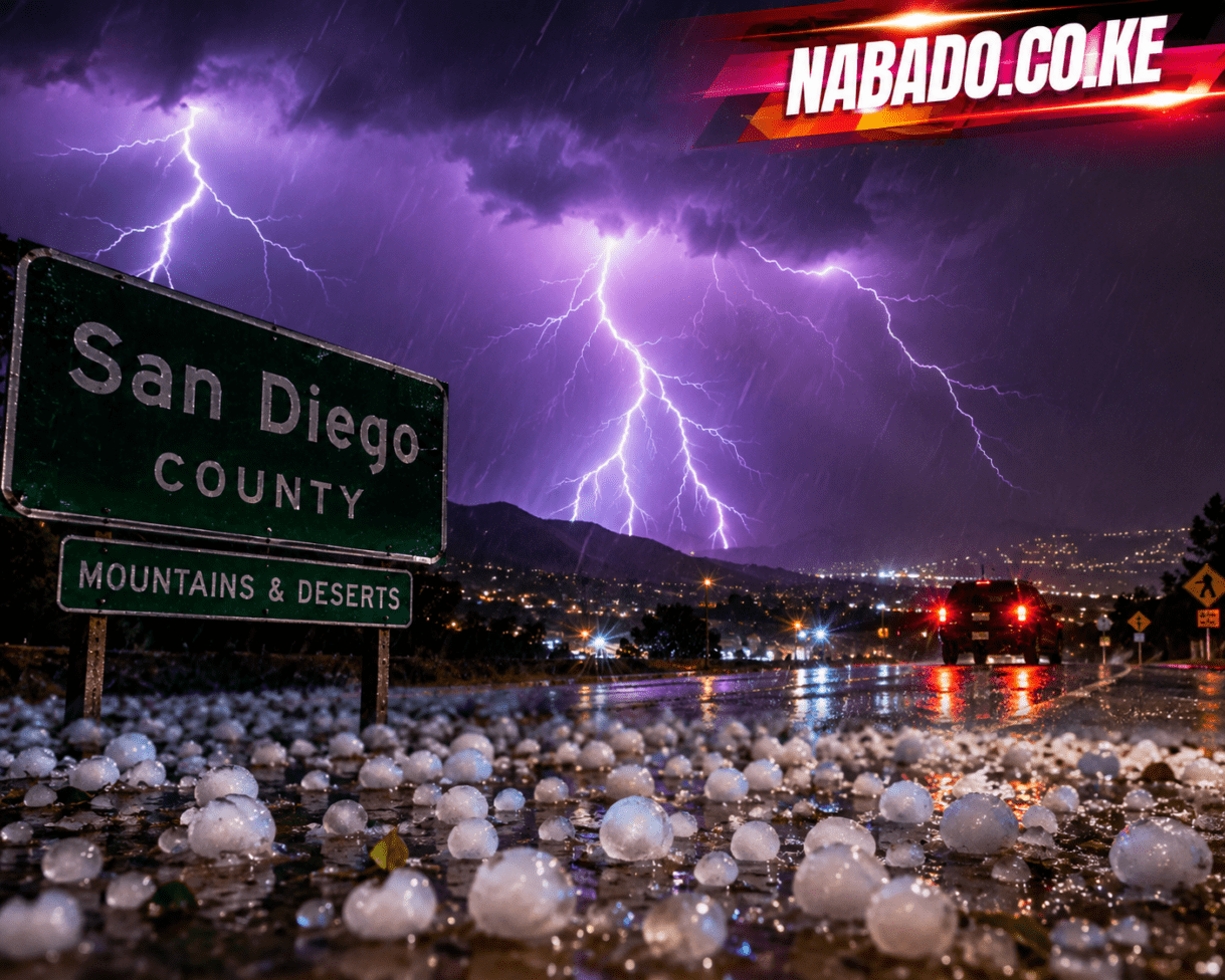
SAN DIEGO — Residents across parts of San Diego County’s mountains and deserts were urged to remain alert Thursday night after thunderstorms rolled across the region, bringing intense lightning, strong winds and the threat of marble-sized hail.
The storms developed over eastern San Diego County as warm, unstable air helped fuel thunderstorms across the higher elevations and desert areas.
For residents accustomed to Southern California’s typically dry summer evenings, the sudden arrival of thunder, lightning and hail created a dramatic change in conditions.
The strongest storm was tracked near Interstate 8 between Boulevard and the Imperial County line, according to weather officials. The storm was moving west at roughly 20 mph as it passed through eastern parts of the county.
Marble-sized hail adds to the danger
Hail was one of the biggest concerns associated with the thunderstorms.
Weather officials warned that some of the strongest cells could produce hail measuring around half an inch across — roughly the size of a marble.
Although relatively small compared with the largest hailstones produced by severe storms elsewhere in the United States, marble-sized hail can still cause problems.
Vehicles parked outdoors can be damaged, while gardens, crops and exposed property may also be affected when hail falls heavily.
The thunderstorms were also capable of producing wind gusts approaching 50 mph, potentially creating hazardous conditions for motorists and residents in exposed areas.
Lightning lights up San Diego’s night sky
The storms also produced an impressive lightning display.
Repeated flashes were seen across parts of the county as thunderstorms moved through the mountains and deserts. Videos shared online showed the night sky repeatedly lighting up as lightning crossed the storm clouds.
For some residents, the spectacle was breathtaking.
But behind the dramatic display was a potentially dangerous weather system.
Lightning can strike areas outside the heaviest rainfall, meaning people do not necessarily have to be directly underneath a storm to face a risk.
Anyone caught outdoors during a thunderstorm is advised to move indoors or into a fully enclosed vehicle and remain there until the storm has passed.
Communities in the storm’s path
The weather threat focused largely on eastern and southeastern sections of San Diego County.
Areas including Boulevard, Campo, Jacumba, Live Oak Springs and Tierra del Sol, along with parts of the Mount Laguna area and communities near Interstate 8, were among the locations affected or threatened by the storms.
The region’s mountainous terrain can help thunderstorms develop when warm, moist air rises and becomes unstable.
That combination can result in storms developing rapidly, sometimes producing heavy rain, gusty winds, hail and frequent lightning within a relatively short period.
Why San Diego gets summer thunderstorms
Thunderstorms are not unusual in the mountains and deserts of Southern California during certain summer weather patterns, although they are much less common along the immediate San Diego coastline.
Inland areas heat up considerably during summer. When moisture moves into the region and atmospheric conditions become unstable, rising air can trigger thunderstorms.
The mountains can further encourage rising air, helping storms form or intensify.
The result can be a sharp contrast between locations only a few dozen miles apart. While coastal neighborhoods may remain dry and relatively calm, residents farther inland can experience heavy rain, lightning and hail.
Drivers face difficult conditions
The storms also presented challenges for people traveling through San Diego County’s mountain and desert roads.
Sudden heavy rain can dramatically reduce visibility, while hail can make road surfaces slick. Strong crosswinds can also make driving more difficult, particularly for high-profile vehicles.
Motorists encountering thunderstorms should reduce their speed, increase their following distance and avoid attempting to drive through flooded roadways.
Flash flooding is another potential danger whenever heavy rainfall develops over a short period, particularly in low-lying areas and places with poor drainage.
Residents urged to monitor weather updates
The latest storms are another reminder that summer weather in San Diego County can change quickly.
Residents in the mountains and deserts are encouraged to monitor updated forecasts and weather alerts whenever thunderstorms begin developing nearby.
The National Weather Service continues to monitor thunderstorm activity across the region, with the strongest storms capable of producing lightning, hail, heavy rainfall and powerful wind gusts.
For those who witnessed the storm, the lightning may have been the most memorable part of the night.
But the combination of marble-sized hail, 50-mph winds and frequent lightning meant the weather system was more than just a spectacular light show.
As summer continues, residents across San Diego County’s inland communities will need to remain prepared for more sudden thunderstorms, particularly when heat and atmospheric moisture combine to create unstable conditions.
For the latest weather warnings, residents should follow updates from the National Weather Service and local emergency officials.
SUGGESTED READS
- Inside the Supreme Court: The Invisible Power That Decides Nations, Rights, and the Fate of Justice
- From Tribal Tongue to Global Power: The Untold Story of How English Took Over the World
- The Great Shift: Why the World Is Choosing Experiences Over Possessions
- Naked and Unashamed: The Shocking Truth Behind the World’s Most Controversial Festivals
- How to Love Yourself More Every Day: The Real, Practical Guide to Building Unshakable Self-Worth
- Who Invented Tattooing and Why Humans First Marked Their Skin

Support Our Website!
We appreciate your visit and hope you find our content valuable. If you’d like to support us further, please consider contributing through the TILL NUMBER: 9549825. Your support helps us keep delivering great content!
If you’d like to support Nabado from outside Kenya, we invite you to send your contributions through trusted third-party services such as Remitly, western union, SendWave, or WorldRemit. These platforms are reliable and convenient for international money transfers.
Please use the following details when sending your support:
Phone Number: +254701838999
Recipient Name: Peterson Getuma Okemwa
We sincerely appreciate your generosity and support. Thank you for being part of this journey!